Mapping the world’s inland surface waters: an upgrade to the Global Lakes and Wetlands Database
-
Biodiversity - Flyways
-
Biodiversity - Swimways
This new publication introduces a major update to one of the most widely used global wetland datasets.
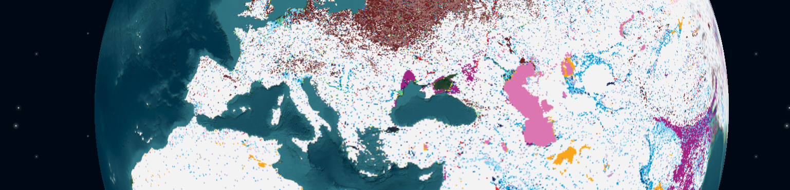
The publication of the Global Lakes and Wetlands Database version 2 integrates decades of satellite and ground data into a single, harmonized, high-resolution map of 33 different inland water and wetland classes.
Taken from the first Database published in 2004, this second version addresses inconsistencies in previous mapping efforts by distinguishing between permanent and seasonal wetlands, natural and artificial waterbodies, and a range of ecological features like salinity, vegetation, and soil type. With an intuitive classification system and fractional grid cell coverage, this powerful new tool provides researchers, conservationists, and policymakers with a detailed baseline for monitoring and managing wetland ecosystems.